Skip to content
OnBinder
Knowledge Base 🇺🇸 United States

This content applies specifically to United States.

The Difference Between U.S. Hurricane Evacuation Zones and FEMA Flood Zones

Hurricane evacuation zones are systems through which local governments issue action guidance based on imminent storm surge risks and evacuation conditions, while FEMA flood zones are mapping systems that show long-term flood risks. Even if the same letters are used on both maps, they do not have the same meaning, so you should check both the zone for your address and current evacuation orders.

Listen or read this article

14:58

Listen, or read the text only.

The Difference Between U.S. Hurricane Evacuation Zones and FEMA Flood Zones

Kokoro 82M AI-generated voice 15 min read

0:00 14:58

Advertisement

Download audio

File name
hurricane-evacuation-zones-vs-fema-flood-zones-en.mp3
Format
MP3 (audio/mpeg)
Duration
14:58
File size
10.3 MB
Engine
Kokoro 82M

This audio was generated by AI.

You may download and use it freely for personal use.

The Difference Between U.S. Hurricane Evacuation Zones and FEMA Flood Zones

12 min read

The Difference Between U.S. Hurricane Evacuation Zones and FEMA Flood Zones
Hurricane evacuation zones are systems through which local governments issue action guidance based on imminent storm surge risks and evacuation conditions, while FEMA flood zones are mapping systems that show long-term flood risks. Even if the same letters are used on both maps, they do not have the same meaning, so you should check both the zone for your address and current evacuation orders.
Hurricane evacuation zones are disaster response systems operated by local governments, based primarily on storm surge risks and the time required for evacuation.
FEMA flood zones indicate long-term flood risk and are used for decisions involving flood insurance, loans, construction, and land use.
A home shown as being at relatively low risk on a FEMA map may still be included in a priority evacuation zone because of storm surge or the risk of isolation.
Evacuation decisions should be based on the latest official evacuation orders from the relevant county or city, not on FEMA flood zones.
When reviewing real estate risks, you should check FEMA maps currently in effect, map revision records, and data on the building's location and elevation together.
In the United States, hurricane evacuation zones and FEMA flood zones both appear on maps, but they do not measure the same risk. One is a system for determining when people should relocate as a disaster approaches, while the other classifies long-term flood risk.
Both maps may use zone designations such as A, B, or numbers, making them easy to confuse. However, they are established by different agencies using different data and for different purposes, so zone names alone should not be compared.
Key Difference: Action Maps vs. Long-Term Risk Maps
Category | Hurricane Evacuation Zone | FEMA Flood Zone Primary purpose | Determine the order and scope of resident evacuations during a hurricane | Show long-term risks of flooding from rivers, coasts, and rainfall Responsible authority | Local governments, such as counties and cities, and state emergency management agencies | FEMA and participating communities Main criteria | Storm surge models, terrain and elevation, access to coasts and waterways, road networks, and evacuation time | Expected flood extent and depth, annual probability, coastal wave effects, and other factors Main time of use | Emergency response before and during a hurricane | Home sales, insurance, lending, construction, and long-term risk management Nature of the result | Required actions vary according to the actual storm’s track and intensity and government orders | Baseline risk classification shown on a map effective at a particular time Official source to check | Emergency management agency for the county or city with jurisdiction over the address | FEMA Map Service Center and local government flood management department
Simply put, an evacuation zone map shows how to act during the current disaster, while a FEMA flood zone map is used to review the flood risks affecting a particular property.
How Hurricane Evacuation Zones Are Determined
Hurricane evacuation zones are established by local governments to move residents to safe locations. In coastal areas, the risk of storm surge, in which seawater is pushed inland, is an important criterion.
The following factors are generally considered together:
· Storm intensity and expected storm surge height · Ground elevation and distance from the coast, bays, rivers, and canals · Terrain with limited exits, such as islands, peninsulas, and barrier islands · The possibility that bridges and major roads may flood or be closed · The time required to move the population safely · Separate guidance for mobile homes and structurally vulnerable housing types
Evacuation zone classification systems are not standardized nationwide. Some areas use several letters beginning with A, while others use numbers beginning with 1. Some places, such as New York City, operate their own 1–6 system. Therefore, Zone A in one county cannot be assumed to represent the same level of risk as Zone A in another county.
Being in an evacuation zone also does not mean that evacuation is always required. The actual standard for action is the current voluntary or mandatory evacuation order issued by the government with jurisdiction for that zone. Conversely, even outside a mapped evacuation zone, different guidance may apply to residents of mobile homes, people who depend on medical equipment, or groups separately designated by the local government.
What FEMA Flood Zones Show
FEMA’s Flood Insurance Rate Map and National Flood Hazard Layer show long-term risks from river flooding, coastal flooding, and some rainfall flooding based on probability and hydraulic and hydrologic analyses. The maps are used for insurance under the National Flood Insurance Program, community floodplain management, building standards, and housing finance decisions.
Common zones include the following:
Example FEMA Zone | General Meaning A, AE, AO, AH | Inland, riverine, and shallow-flooding zones within a Special Flood Hazard Area; specific annual probability criteria should be checked in FEMA’s official zone descriptions V, VE | Zones where coastal flooding and wave action risks are considered together; specific annual probability criteria should be checked in FEMA’s official zone descriptions Shaded X zone | A zone generally shown as having moderate risk; specific annual probability criteria should be checked in FEMA’s official zone descriptions Unshaded X zone | A zone classified on the map as having relatively low risk, but not as having no possibility of flooding
The annual probability shown on the map does not mean that flooding occurs only once within a given period, and the specific probability criteria should be checked in FEMA’s official zone descriptions. It is a statistical expression of the likelihood of occurrence in any given year, and its exact meaning should be checked in FEMA’s official zone descriptions.
If a building securing a loan from a federally regulated lender is located in a Special Flood Hazard Area, flood insurance may be required. However, lenders may also require insurance outside mapped high-risk zones, and the actual insurance requirements should be confirmed based on the lender, insurer, effective map, and building location.
Why a Home at Low Flood Risk May Still Be Evacuated First
It is not contradictory for a home shown in an X zone on a FEMA flood map to be included in a local government’s priority evacuation zone. The two systems answer different questions.
Possible reasons include the following:
· The storm surge scenarios differ. FEMA flood maps classify long-term risk according to specific mapping criteria, while evacuation plans focus on life safety and storm surge scenarios that could be caused by a strong hurricane. · The travel route may become dangerous before the home does. Even if the home itself is on high ground, the entire area may become isolated if access roads, bridges, or causeways flood first. · Evacuation takes time. In densely populated coastal areas, moving people from lower zones in stages before the storm gets close can reduce traffic congestion. · The map does not directly assess a building’s structural safety. Mobile homes or buildings vulnerable to wind loads may be subject to evacuation regardless of their flood zone. · The map’s publication date may not reflect actual current terrain. New development, changes to drainage facilities, coastal changes, or delays in map revisions may mean that current conditions are not fully reflected on the map.
The opposite situation is also possible. A home near an inland river may be within a FEMA Special Flood Hazard Area but outside a hurricane evacuation zone based on coastal storm surge. Even in this case, the risks of heavy rainfall or river flooding and any separate emergency instructions from the local government should continue to be monitored.
Why the Same Zone A Does Not Mean the Same Thing
The designation “Zone A” can mean entirely different things depending on which map is being viewed.
· On a local government evacuation map, Evacuation Zone A may generally refer to an area designated for evacuation first. · On a FEMA map, Flood Zone A is a type of Special Flood Hazard Area, and the specific annual probability criteria should be checked in FEMA’s official zone descriptions. · Evacuation Zone A in another county may use different zoning methods and evacuation criteria.
Therefore, if a search result or real estate listing says only “Zone A,” the map name, issuing authority, and effective date should be checked. There is no official conversion table matching evacuation classifications with FEMA flood classifications.
How to Check Evacuation Orders and Address-Specific Zones
For safety, evacuation decisions and property risk reviews should be checked separately as follows.
1. Identify the Local Government With Jurisdiction Over the Address
In the United States, evacuation zones and evacuation orders are primarily managed by counties or cities. After identifying the county and city in which the address is located, use that government’s emergency management or evacuation zone page.
2. Look Up the Evacuation Zone for the Address
Enter the address in the local government’s official address search tool. In Florida, the Florida Division of Emergency Management’s Know Your Zone guidance can be used as a starting point, but actual orders and detailed maps should be confirmed again through the official channels of the county with jurisdiction.
3. Check Current Evacuation Orders Separately
A zone map is a baseline plan, while an evacuation order is an administrative decision for the current storm. Check the jurisdiction’s government website, official emergency alerts, local broadcasts, and emergency management agency notices together. Forecasts from NOAA and the National Hurricane Center provide information for understanding storm conditions, but they do not replace local government evacuation orders.
4. Use FEMA Maps to Check Property Risk
Search the address in the FEMA Map Service Center to identify the effective Flood Insurance Rate Map, panel number, map effective date, and zone. For real estate transactions or insurance decisions, it is more appropriate to use official map records and a professional determination than a simple screenshot.
5. If the Results Conflict, Prioritize the Evacuation Order
Even if the FEMA map appears to show low risk, an order issued by the government with jurisdiction for the address’s evacuation zone is the current standard for action. A difference between the two results does not mean that either map is necessarily incorrect.
What to Check When Address Search Results Differ
On online maps, an address may be near a boundary, or different websites may provide different results. This can result from differences in map data, address coordinates, or display units.
· Check whether the search pin is placed on the actual building rather than at the center of the parcel or on the road. · Determine whether the FEMA map is the currently effective map or a preliminary map that has not yet taken effect. · If a parcel has multiple buildings, check which zone contains the building subject to the insurance determination. · Check the original panel to determine whether the map scale merely makes the boundary appear to cross the building. · Check for official map change records, such as a Letter of Map Amendment or Letter of Map Revision. · Review the official determination documents required by the local government floodplain administrator, insurer, or lender.
A FEMA zone also does not directly show the actual elevation of the land or building floor. Foundation height, lowest-floor elevation, drainage conditions, and building structure can affect the actual extent of losses. Insurance or construction issues for a home on a boundary are difficult to resolve based solely on the map color.
Compound Risks Not Shown on the Maps
Checking these two types of zones alone does not reveal every hurricane risk. In addition to storm surge, hurricanes can cause high winds, tornadoes, prolonged power outages, sewer backups, heavy rainfall, and inland river flooding.
Even when remaining outside an evacuation zone, the following should be reviewed separately:
· Whether the building can withstand the expected wind speed · Whether there is a safe indoor space that will not flood · Whether necessary medications and medical equipment can be used during a power outage · Whether nearby roads and bridges may be closed · Whether pet-friendly shelters and transportation are available · Whether prolonged isolation can be managed if evacuation is not undertaken
In other words, looking up a zone is a starting point for decision-making, not a single determination that replaces a complete disaster plan.
Which Map to Use in Each Situation
What You Want to Check | Source to Check First Whether to evacuate for this hurricane | Latest evacuation order from the county or city with jurisdiction Which evacuation stage applies to the address | Local government’s official evacuation zone address lookup tool The level of the home’s long-term flood risk | Effective FEMA flood map and local government risk information Whether flood insurance is required for a mortgage | FEMA map and the lender’s official determination How insurance premiums or coverage terms are determined | Quote and terms from an insurer or an insurance agent handling NFIP policies Whether roads and bridges are currently passable | Real-time notices from local government and state transportation agencies
The most important principle is not to use property risk maps and disaster action maps as substitutes for one another. When buying a home, flood risk should not be judged solely from the evacuation zone, and when a hurricane approaches, the decision to evacuate should not be based solely on the FEMA flood zone.
0:00 0:00
1 / 57

Advertisement

Download text

File name
hurricane-evacuation-zones-vs-fema-flood-zones-en.txt
Format
TXT (text/plain)
Paragraphs
57

Downloads exactly what you see as a text file.

Please cite the source when quoting.

Large text

Makes the text larger and the colors clearer. Turn it on if the text feels too small.

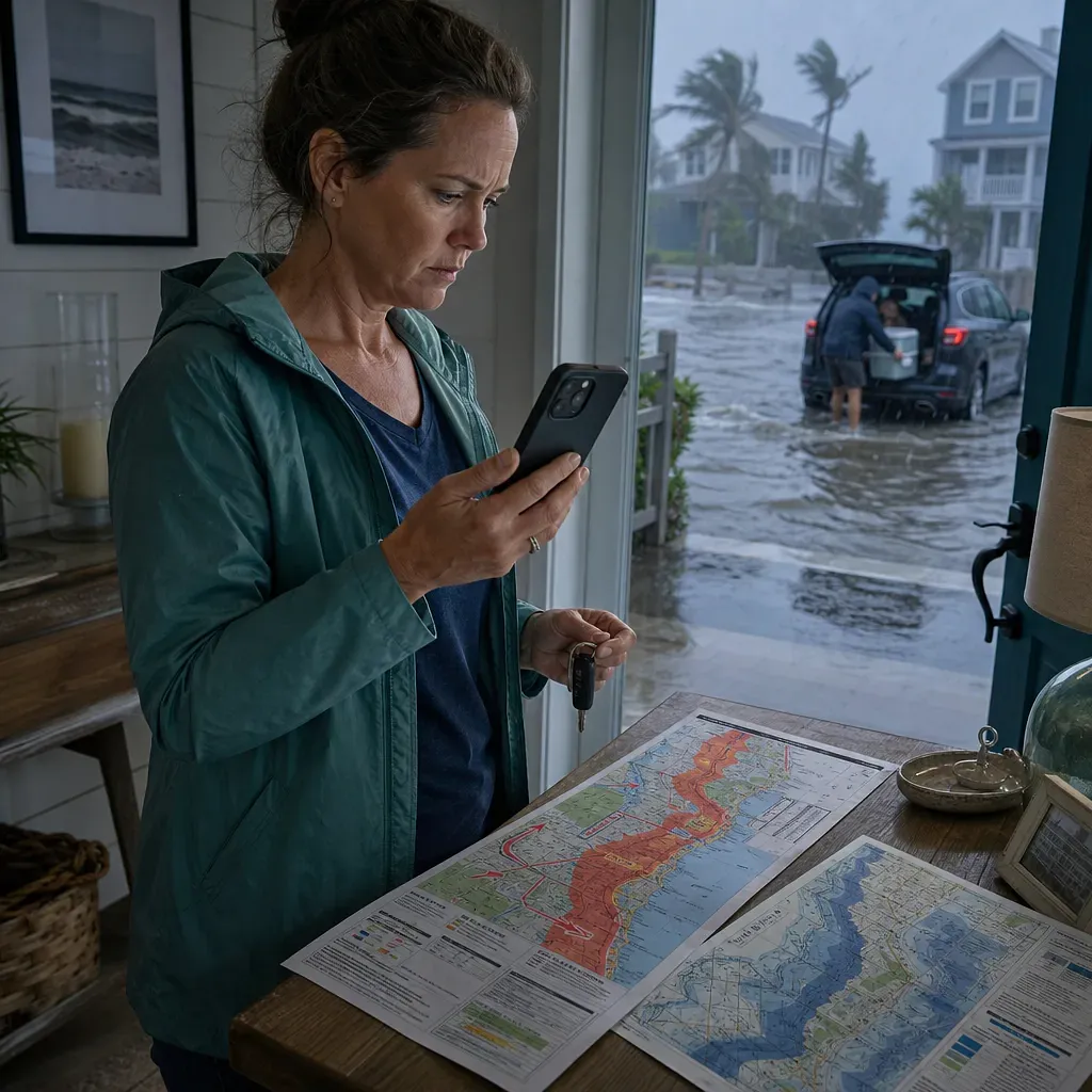
Residents prepare to evacuate as hurricane flooding covers the street outside.

Key points

  • Hurricane evacuation zones are disaster response systems operated by local governments, based primarily on storm surge risks and the time required for evacuation.
  • FEMA flood zones indicate long-term flood risk and are used for decisions involving flood insurance, loans, construction, and land use.
  • A home shown as being at relatively low risk on a FEMA map may still be included in a priority evacuation zone because of storm surge or the risk of isolation.
  • Evacuation decisions should be based on the latest official evacuation orders from the relevant county or city, not on FEMA flood zones.
  • When reviewing real estate risks, you should check FEMA maps currently in effect, map revision records, and data on the building's location and elevation together.

In the United States, hurricane evacuation zones and FEMA flood zones both appear on maps, but they do not measure the same risk. One is a system for determining when people should relocate as a disaster approaches, while the other classifies long-term flood risk.

Both maps may use zone designations such as A, B, or numbers, making them easy to confuse. However, they are established by different agencies using different data and for different purposes, so zone names alone should not be compared.

Key Difference: Action Maps vs. Long-Term Risk Maps

Category Hurricane Evacuation Zone FEMA Flood Zone
Primary purpose Determine the order and scope of resident evacuations during a hurricane Show long-term risks of flooding from rivers, coasts, and rainfall
Responsible authority Local governments, such as counties and cities, and state emergency management agencies FEMA and participating communities
Main criteria Storm surge models, terrain and elevation, access to coasts and waterways, road networks, and evacuation time Expected flood extent and depth, annual probability, coastal wave effects, and other factors
Main time of use Emergency response before and during a hurricane Home sales, insurance, lending, construction, and long-term risk management
Nature of the result Required actions vary according to the actual storm’s track and intensity and government orders Baseline risk classification shown on a map effective at a particular time
Official source to check Emergency management agency for the county or city with jurisdiction over the address FEMA Map Service Center and local government flood management department

Simply put, an evacuation zone map shows how to act during the current disaster, while a FEMA flood zone map is used to review the flood risks affecting a particular property.

How Hurricane Evacuation Zones Are Determined

Hurricane evacuation zones are established by local governments to move residents to safe locations. In coastal areas, the risk of storm surge, in which seawater is pushed inland, is an important criterion.

The following factors are generally considered together:

  • Storm intensity and expected storm surge height
  • Ground elevation and distance from the coast, bays, rivers, and canals
  • Terrain with limited exits, such as islands, peninsulas, and barrier islands
  • The possibility that bridges and major roads may flood or be closed
  • The time required to move the population safely
  • Separate guidance for mobile homes and structurally vulnerable housing types

Evacuation zone classification systems are not standardized nationwide. Some areas use several letters beginning with A, while others use numbers beginning with 1. Some places, such as New York City, operate their own 1–6 system. Therefore, Zone A in one county cannot be assumed to represent the same level of risk as Zone A in another county.

Being in an evacuation zone also does not mean that evacuation is always required. The actual standard for action is the current voluntary or mandatory evacuation order issued by the government with jurisdiction for that zone. Conversely, even outside a mapped evacuation zone, different guidance may apply to residents of mobile homes, people who depend on medical equipment, or groups separately designated by the local government.

What FEMA Flood Zones Show

FEMA’s Flood Insurance Rate Map and National Flood Hazard Layer show long-term risks from river flooding, coastal flooding, and some rainfall flooding based on probability and hydraulic and hydrologic analyses. The maps are used for insurance under the National Flood Insurance Program, community floodplain management, building standards, and housing finance decisions.

Common zones include the following:

Example FEMA Zone General Meaning
A, AE, AO, AH Inland, riverine, and shallow-flooding zones within a Special Flood Hazard Area; specific annual probability criteria should be checked in FEMA’s official zone descriptions
V, VE Zones where coastal flooding and wave action risks are considered together; specific annual probability criteria should be checked in FEMA’s official zone descriptions
Shaded X zone A zone generally shown as having moderate risk; specific annual probability criteria should be checked in FEMA’s official zone descriptions
Unshaded X zone A zone classified on the map as having relatively low risk, but not as having no possibility of flooding

The annual probability shown on the map does not mean that flooding occurs only once within a given period, and the specific probability criteria should be checked in FEMA’s official zone descriptions. It is a statistical expression of the likelihood of occurrence in any given year, and its exact meaning should be checked in FEMA’s official zone descriptions.

If a building securing a loan from a federally regulated lender is located in a Special Flood Hazard Area, flood insurance may be required. However, lenders may also require insurance outside mapped high-risk zones, and the actual insurance requirements should be confirmed based on the lender, insurer, effective map, and building location.

Why a Home at Low Flood Risk May Still Be Evacuated First

It is not contradictory for a home shown in an X zone on a FEMA flood map to be included in a local government’s priority evacuation zone. The two systems answer different questions.

Possible reasons include the following:

  1. The storm surge scenarios differ. FEMA flood maps classify long-term risk according to specific mapping criteria, while evacuation plans focus on life safety and storm surge scenarios that could be caused by a strong hurricane.
  2. The travel route may become dangerous before the home does. Even if the home itself is on high ground, the entire area may become isolated if access roads, bridges, or causeways flood first.
  3. Evacuation takes time. In densely populated coastal areas, moving people from lower zones in stages before the storm gets close can reduce traffic congestion.
  4. The map does not directly assess a building’s structural safety. Mobile homes or buildings vulnerable to wind loads may be subject to evacuation regardless of their flood zone.
  5. The map’s publication date may not reflect actual current terrain. New development, changes to drainage facilities, coastal changes, or delays in map revisions may mean that current conditions are not fully reflected on the map.

The opposite situation is also possible. A home near an inland river may be within a FEMA Special Flood Hazard Area but outside a hurricane evacuation zone based on coastal storm surge. Even in this case, the risks of heavy rainfall or river flooding and any separate emergency instructions from the local government should continue to be monitored.

Why the Same Zone A Does Not Mean the Same Thing

The designation “Zone A” can mean entirely different things depending on which map is being viewed.

  • On a local government evacuation map, Evacuation Zone A may generally refer to an area designated for evacuation first.
  • On a FEMA map, Flood Zone A is a type of Special Flood Hazard Area, and the specific annual probability criteria should be checked in FEMA’s official zone descriptions.
  • Evacuation Zone A in another county may use different zoning methods and evacuation criteria.

Therefore, if a search result or real estate listing says only “Zone A,” the map name, issuing authority, and effective date should be checked. There is no official conversion table matching evacuation classifications with FEMA flood classifications.

How to Check Evacuation Orders and Address-Specific Zones

For safety, evacuation decisions and property risk reviews should be checked separately as follows.

1. Identify the Local Government With Jurisdiction Over the Address

In the United States, evacuation zones and evacuation orders are primarily managed by counties or cities. After identifying the county and city in which the address is located, use that government’s emergency management or evacuation zone page.

2. Look Up the Evacuation Zone for the Address

Enter the address in the local government’s official address search tool. In Florida, the Florida Division of Emergency Management’s Know Your Zone guidance can be used as a starting point, but actual orders and detailed maps should be confirmed again through the official channels of the county with jurisdiction.

3. Check Current Evacuation Orders Separately

A zone map is a baseline plan, while an evacuation order is an administrative decision for the current storm. Check the jurisdiction’s government website, official emergency alerts, local broadcasts, and emergency management agency notices together. Forecasts from NOAA and the National Hurricane Center provide information for understanding storm conditions, but they do not replace local government evacuation orders.

4. Use FEMA Maps to Check Property Risk

Search the address in the FEMA Map Service Center to identify the effective Flood Insurance Rate Map, panel number, map effective date, and zone. For real estate transactions or insurance decisions, it is more appropriate to use official map records and a professional determination than a simple screenshot.

5. If the Results Conflict, Prioritize the Evacuation Order

Even if the FEMA map appears to show low risk, an order issued by the government with jurisdiction for the address’s evacuation zone is the current standard for action. A difference between the two results does not mean that either map is necessarily incorrect.

What to Check When Address Search Results Differ

On online maps, an address may be near a boundary, or different websites may provide different results. This can result from differences in map data, address coordinates, or display units.

  • Check whether the search pin is placed on the actual building rather than at the center of the parcel or on the road.
  • Determine whether the FEMA map is the currently effective map or a preliminary map that has not yet taken effect.
  • If a parcel has multiple buildings, check which zone contains the building subject to the insurance determination.
  • Check the original panel to determine whether the map scale merely makes the boundary appear to cross the building.
  • Check for official map change records, such as a Letter of Map Amendment or Letter of Map Revision.
  • Review the official determination documents required by the local government floodplain administrator, insurer, or lender.

A FEMA zone also does not directly show the actual elevation of the land or building floor. Foundation height, lowest-floor elevation, drainage conditions, and building structure can affect the actual extent of losses. Insurance or construction issues for a home on a boundary are difficult to resolve based solely on the map color.

Compound Risks Not Shown on the Maps

Checking these two types of zones alone does not reveal every hurricane risk. In addition to storm surge, hurricanes can cause high winds, tornadoes, prolonged power outages, sewer backups, heavy rainfall, and inland river flooding.

Even when remaining outside an evacuation zone, the following should be reviewed separately:

  • Whether the building can withstand the expected wind speed
  • Whether there is a safe indoor space that will not flood
  • Whether necessary medications and medical equipment can be used during a power outage
  • Whether nearby roads and bridges may be closed
  • Whether pet-friendly shelters and transportation are available
  • Whether prolonged isolation can be managed if evacuation is not undertaken

In other words, looking up a zone is a starting point for decision-making, not a single determination that replaces a complete disaster plan.

Which Map to Use in Each Situation

What You Want to Check Source to Check First
Whether to evacuate for this hurricane Latest evacuation order from the county or city with jurisdiction
Which evacuation stage applies to the address Local government’s official evacuation zone address lookup tool
The level of the home’s long-term flood risk Effective FEMA flood map and local government risk information
Whether flood insurance is required for a mortgage FEMA map and the lender’s official determination
How insurance premiums or coverage terms are determined Quote and terms from an insurer or an insurance agent handling NFIP policies
Whether roads and bridges are currently passable Real-time notices from local government and state transportation agencies

The most important principle is not to use property risk maps and disaster action maps as substitutes for one another. When buying a home, flood risk should not be judged solely from the evacuation zone, and when a hurricane approaches, the decision to evacuate should not be based solely on the FEMA flood zone.

Sign-in required

Sign in with your Google account to like, comment, and save highlights.

Images

Residents prepare to evacuate as hurricane flooding covers the street outside.
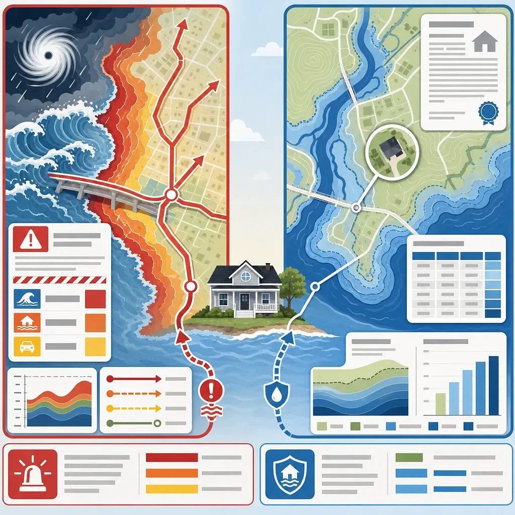
The left shows hurricane evacuation zones, while the right depicts FEMA flood zones.

FAQ

Are hurricane evacuation zones and FEMA flood zones shown on the same map?

No. Evacuation zone maps are emergency response maps used by local governments to determine the order in which residents should evacuate based on storm surge and evacuation conditions. FEMA flood zones show long-term flood risk and are used for insurance, lending, construction, and land use.

If I am in FEMA Flood Zone X, does that mean I do not need to evacuate?

That conclusion cannot be made. Zone X indicates relatively low or moderate long-term flood risk on FEMA maps, but an area may still be included in a local government's evacuation zone because of storm surge and the possibility of roads becoming inaccessible. Whether you should evacuate now must be confirmed through the latest orders from the government with jurisdiction.

If both the evacuation map and the FEMA map show Zone A, do they mean the same thing?

They do not mean the same thing. Zone A on an evacuation map is the evacuation level for that area, while FEMA Flood Zone A is a type of Special Flood Hazard Area; the specific annual probability criterion should be confirmed in FEMA's official zone descriptions. There is no common nationwide standard that directly maps the two classifications to each other.

Is a FEMA high-risk flood zone always included in a hurricane evacuation zone?

Not necessarily. Areas with a high risk of inland river flooding may be included in a FEMA Special Flood Hazard Area but excluded from evacuation zones focused on coastal storm surge. Separate emergency instructions for heavy rainfall or river flooding may still apply.

Where should I check for hurricane evacuation orders?

You should check the emergency management agency website and official emergency alerts for the county or city with jurisdiction over your address. Information from the state emergency management agency and the National Hurricane Center is useful for understanding the situation, but announcements from the local government with jurisdiction are the authoritative source for actual local evacuation orders.

Where can I look up FEMA flood zones?

By searching for an address in the FEMA Map Service Center, you can view the effective flood map, map panel, and zone information. If you need an official determination for insurance or lending purposes, you should verify the official information with the lender, insurer, or local government floodplain administrator.

Does a home outside a FEMA flood zone not need flood insurance?

Being outside a mapped Special Flood Hazard Area does not mean there is no flood risk. A lender may require insurance, and an owner may also purchase it voluntarily for risk management. The need and terms should be assessed by reviewing the effective map, loan agreement, and insurance quote together.

Why do different online maps show different flood zone results?

They may differ in whether they use effective or preliminary maps, the location of the address coordinates, the distinction between the parcel and the building, the map scale, or when official map revisions were incorporated. For a home on a boundary, it is advisable to check the original FEMA panel and map revision records and request an official determination from the local government or lender.

Where can I find the annual probability criteria and meanings of FEMA flood zones?

No. It means that a flood of a certain magnitude or greater may occur each year with a certain probability, and the specific probability criteria should be confirmed in FEMA's official zone descriptions. It may occur repeatedly within a short period and does not mean that it will occur exactly once during a given period.

If I am outside an evacuation zone, is it safe to stay home during a hurricane?

Being outside an evacuation zone alone does not guarantee safety. The risks of high winds, tornadoes, heavy rainfall, power outages, disruption of medical equipment, and road closures must be considered separately, and people such as mobile home residents may receive evacuation instructions that differ from the zone-based guidance.

Sources

Also available as video and a short read

Videos and a short write-up made from this content. Watch instead of reading, or skim the gist first.

Short version

Loading…

Data formats

This content is available in several machine-friendly formats.

Data-only languages (machine translated, files only)

Indonesian JSON MD Portuguese JSON MD Chinese (Traditional) JSON MD Deutsch JSON MD

Verification

Reviewed by 신익희 · 편집장 · 2026-08-30

Figures in this article were checked against the source material during generation. 10 correction(s) applied. · 2026-08-30

This translation has been cross-checked by AI. · 2026-08-30

Reuse & AI usage

Search indexing and AI citation with attribution are welcome. See the license policy for details.

CC BY · License

Loading…

Loading…

Related content

From Injoys

Request the content you want and take 70% of what it earns

Just leave the subject. We handle production, review, translation and distribution.

See how revenue sharing works

Comments