Skip to content
OnBinder
How-to 🇺🇸 United States

This content applies specifically to United States.

FEMA Flood Map and Insurance Lookup by Address

Learn how to look up a U.S. property's FEMA flood zone by address and interpret Zone X and AE. This guide distinguishes the eligibility and coverage conditions for NFIP flood insurance, standard homeowners insurance, and FEMA individual disaster assistance, as well as how to respond after damage occurs.

Listen or read this article

13:41

Listen, or read the text only.

FEMA Flood Map and Insurance Lookup by Address

Kokoro 82M AI-generated voice 14 min read

0:00 13:41

Advertisement

Download audio

File name
fema-flood-map-address-check-nfip-guide-en.mp3
Format
MP3 (audio/mpeg)
Duration
13:41
File size
9.4 MB
Engine
Kokoro 82M

This audio was generated by AI.

You may download and use it freely for personal use.

FEMA Flood Map and Insurance Lookup by Address

11 min read

FEMA Flood Map and Insurance Lookup by Address
Learn how to look up a U.S. property's FEMA flood zone by address and interpret Zone X and AE. This guide distinguishes the eligibility and coverage conditions for NFIP flood insurance, standard homeowners insurance, and FEMA individual disaster assistance, as well as how to respond after damage occurs.
Search the full address in the FEMA Flood Map Service Center.
Save the flood zone and effective FIRM panel information shown in the results.
Review the meanings of Zone X and AE together with the Elevation Certificate.
Ask the lender and insurer about insurance requirements and coverage.
If damage occurs, file an insurance claim and apply for disaster assistance separately.
Enter a U.S. address in the FEMA Flood Map Service Center to check Zone X or AE and the applicable FIRM panel. Check the FEMA official page for the information required for a search and whether applications have closed. Apply for disaster assistance only in declared areas, and check the deadline at DisasterAssistance.gov.
Based on relevant forecasts and cases as of August 2026; check FEMA official pages for program details
How to Look Up an Address on a FEMA Flood Map
Start your address search at the FEMA Flood Map Service Center. Have the street name and number, city, state, and ZIP code ready. For an apartment, search for the building address first.
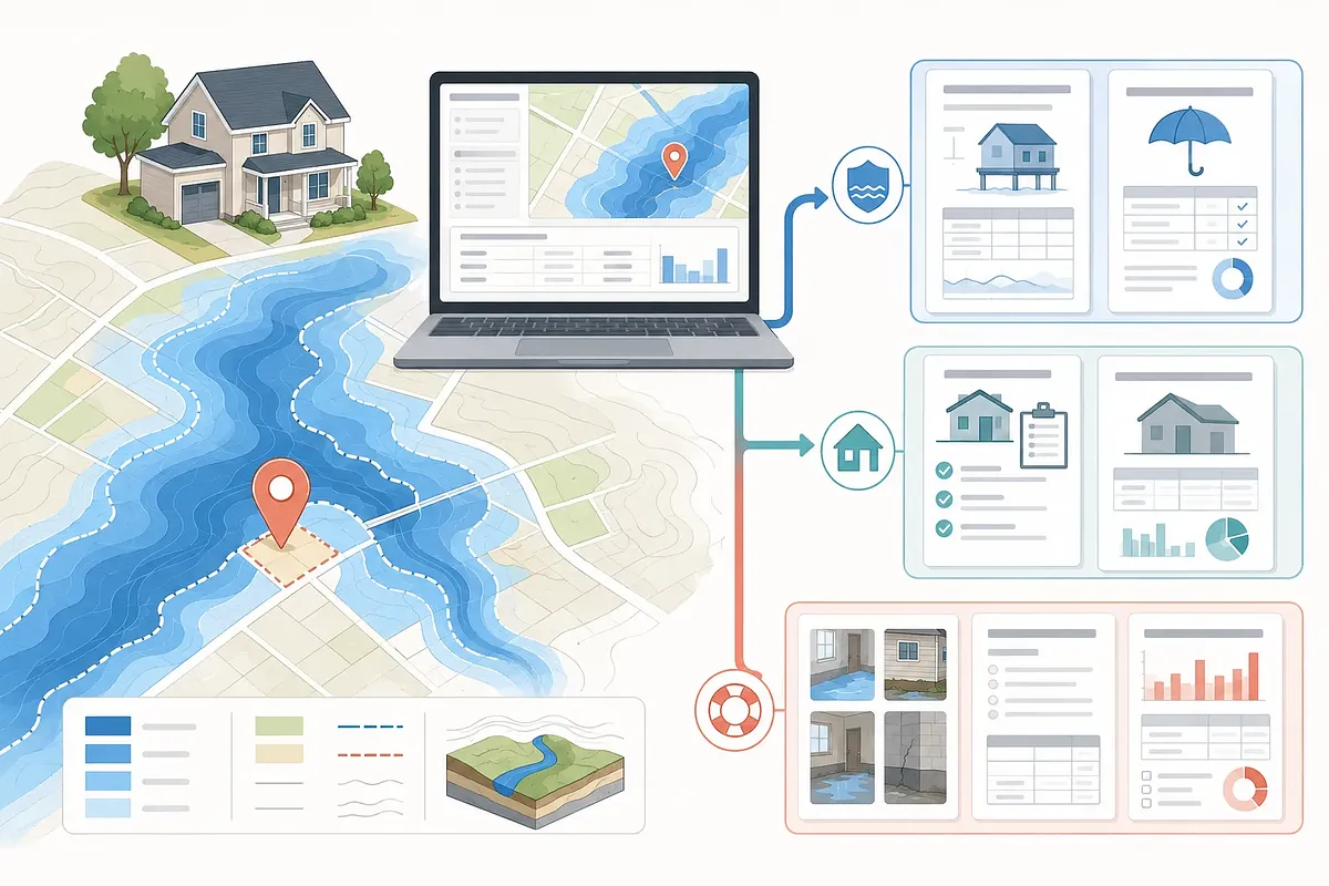
· Open the FEMA Flood Map Service Center search page. · Enter the property’s full address. · Confirm the parcel’s location on the map. · Read the zone designation, such as Zone X or AE. · Record the effective FIRM panel number and effective date. · Download and save the map or related report.
The search point may not align with the building. If so, compare it directly with the parcel location on the map. If the property is near a boundary, do not rely solely on the address result.
Interpreting Zone X and AE Results
Zone AE is a Special Flood Hazard Area with an established base flood elevation. This zone is associated with a flood having a 1% annual chance. It is not an indication predicting flooding within a specific period.
Zone X does not represent just one level of risk. Shaded Zone X may include areas with a 0.2% annual chance of flooding. Unshaded Zone X also does not mean that flooding is impossible.
Map result | Basic meaning | What to check next Zone AE | Special Flood Hazard Area with a base flood elevation shown | Check the lender’s insurance requirements and the building elevation Shaded Zone X | Moderate-risk area on the map | Review drainage, past flooding, and the need for insurance together Unshaded Zone X | Relatively lower-risk area on the map | Separately check risks from localized heavy rain and drainage Near a zone boundary | The result may vary depending on the parcel or building location | Compare the effective panel with survey records
Maps show flood risk across broad areas by zone. They do not fully reflect the drainage conditions of individual buildings. Nearby construction and terrain changes must also be checked separately.
Why Zones Differ Within the Same Development
Even within the same development, zones may differ if parcels have different elevations and locations. Distance from drainage channels and retention ponds can also make a difference. A map boundary may run through the development.
The lowest floor elevation of a building may also vary by parcel. An elevation certificate documents this vertical position. However, not every home has an existing certificate.
Existing records may be available from the following sources:
· The seller or building owner · The local government department responsible for floodplain management · The building permit or property records department · A qualified survey professional
FEMA maps and actual survey results may differ. If the applicable conditions are met, a map change process such as a LOMA may be considered. A map change does not eliminate the physical flood risk itself.
Summary by Situation
The organizations and documents you need to check vary depending on your current situation. Start with the item in the table below that applies to you.
Current situation | First step | Documents or information to check Before buying a home | Look up the zone for each address | Effective FIRM, elevation certificate, flood history Using a mortgage | Ask the lender whether insurance is mandatory | Official zone determination and loan terms Shown as Zone AE | Check the building elevation and insurance terms | Base flood elevation, elevation certificate Shown as Zone X | Do not assume there is no risk | Drainage conditions and insurance quotes Map recently revised | Distinguish previous records from the effective map | Panel effective date and revision history Flood damage has already occurred | Notify the insurer of the loss immediately | Photos, videos, damage inventory, receipts Living in a disaster-declared area | Separately check eligibility for FEMA assistance | Address, damage details, insurance information, application deadline
Even when federal regulations do not require it, a lender may require insurance. Premiums are also not determined solely by the zone letter. Multiple risk factors related to the building and location may be considered.
Comparing NFIP and Homeowners Insurance Coverage
Flood and wind damage are treated separately even when they result from the same hurricane. The direct cause of the damage and the policy terms determine whether coverage applies. First, distinguish the role of each type of insurance.
Category | NFIP flood insurance | Standard homeowners insurance | FEMA individual disaster assistance Conditions for activation | A covered flood occurs while the policy is in effect | A loss covered under the policy occurs | A presidential disaster declaration and an individual eligibility review are required Primary role | Covered flood damage to the building or personal property | Losses covered under the policy, such as fire and some wind damage | Assistance for essential needs not met by insurance Disaster declaration required | No | No | Yes Flood coverage | Based on the purchased coverage and policy terms | Separate flood insurance is generally required | Does not replace insurance Duplicate compensation | Duplicate payment for the same loss is restricted | May be coordinated with other payments | Does not duplicate insurance payments for the same loss Form of payment | Insurance proceeds under the insurance contract | Insurance proceeds under the insurance contract | Assistance based on eligibility and program rules
The fact that an event is called a hurricane does not mean one policy covers everything. Storm surge and surface flooding may constitute flood damage. Check the homeowners insurance policy for wind-related damage.
Building coverage and personal property coverage may be separate. Check each item individually on the policy declarations page. Coverage limitations may apply to property in basement areas.
FEMA Disaster Assistance Eligibility and Deadlines
FEMA individual disaster assistance is not a substitute for flood insurance. The property must be in a designated area under a presidential disaster declaration. The applicant’s damage must also meet program criteria.
Application deadlines vary by disaster. Check the page for the applicable disaster at DisasterAssistance.gov. If an extension is announced, it will be reflected on the official page.
Prepare the following information before applying for assistance:
· The address where the damage occurred and current contact information · Details of damage to the home and property · Types of insurance held and claim information · Information required to verify identity and household · Financial information required to register a payment method
If you have insurance, notify the insurer of the loss first. A FEMA application does not automatically initiate an insurance claim. You may register separately for disaster assistance even before an insurance payment decision is made.
Restrictions on duplicate assistance apply to the same loss. Keep the assistance determination letter together with the insurance payment details. Also check whether there is a requirement to maintain flood insurance in the future.
Steps for Filing an Insurance Claim Immediately After Flooding
After flood damage occurs, preserve evidence once safety has been secured. Even if repairs are urgent, document the damaged condition first. Check the policy and insurer instructions for claim deadlines.
· Check the safety of the electrical system and structures. · Take photos and videos of damage in each area. · Prepare an inventory of damaged items. · Notify the NFIP insurer or insurance agent of the loss. · Keep receipts for emergency expenses and temporary repairs. · If the property is in a disaster-declared area, apply separately for FEMA assistance.
Conducting extensive demolition before insurer approval may make it harder to prove the loss. If items must be discarded for sanitary reasons, photograph them thoroughly first. When possible, retain samples in accordance with the claim instructions.
Examples of Address-Specific Determinations
Two addresses in the same residential development may produce different results. One parcel may be in Zone AE while another is in Zone X. Do not treat two homes as having the same risk based only on the development name.
For example, if a prospective purchase is in Zone AE, check the base flood elevation. Then compare the elevation certificate with the lender’s requirements. Ask the insurer separately about building and personal property coverage.
Do not stop checking even if another candidate is in Zone X. Check whether it is shaded and review the drainage facilities. Obtain and compare insurance terms for each address as well.
Checking Map Revisions and Lender Requirements
The currently effective FIRM generally takes priority for legal and financial decisions. Treat preliminary and historical maps as reference materials. Save both the panel number and effective date.
A lender’s determination may change after a map revision. Conversely, a lender may require insurance even outside a mandatory zone. Obtain the terms in writing before signing a contract.
Use the following order:
· Check the currently effective panel in MSC. · See whether there is a recent revision or preliminary map. · Request the lender’s flood-zone determination. · Confirm the insurance effective date with the insurer. · Review insurance-related deadlines in the purchase contract.
Do not assume that flood insurance takes effect immediately upon purchase. Waiting periods and exceptions may vary depending on the contract circumstances. Check with the insurer before a forecast storm arrives.
Common Mistakes
The most common mistake is interpreting Zone X as a no-risk area. FEMA maps do not guarantee the absence of risk. Drainage problems not shown on the map may also cause flooding.
· Judging a parcel based only on the city name or ZIP code · Treating an outdated FIRM copy as the current map · Assuming all hurricane damage is covered by one policy · Thinking FEMA assistance is the same as insurance proceeds · Treating insurance enrollment and a disaster assistance application as procedures that replace each other · Assuming an elevation certificate automatically changes the mapped zone
Do not apply only for disaster assistance and delay notifying the insurer. The two processes have different purposes and reviews. Keep the submission numbers and documents for each process separately.
Keeping Records Before a Sale or Loan
It is safer to save the search results as an evidence package from the time of the transaction. Online maps may be revised later. Download the official panel rather than relying only on screenshots.
Keep the following materials in one folder:
· FEMA search results showing the address · Effective FIRM panel and effective date · Elevation certificate or survey records · The lender’s flood insurance determination · Insurance quotes and coverage items · Flood-related records disclosed by the seller
These records help distinguish insurance requirements from the basis for the determination at the time. They can also be used to compare future map changes. However, historical files do not replace current risk information.
Where to Check Official Rules
Check the FEMA Flood Map Service Center for the exact map terminology. Zone descriptions are available on FloodSmart’s What Is My Flood Zone page. Check the relevant FEMA guidance for insurance and disaster assistance requirements.
Direct quotations from official rules are not included in this posting. Accordingly, no specific sentence has been quoted as if it were the original text of a regulation. Before making an actual decision, compare the latest official pages with the insurance policy.
0:00 0:00
1 / 66

Advertisement

Download text

File name
fema-flood-map-address-check-nfip-guide-en.txt
Format
TXT (text/plain)
Paragraphs
66

Downloads exactly what you see as a text file.

Please cite the source when quoting.

Large text

Makes the text larger and the colors clearer. Turn it on if the text feels too small.

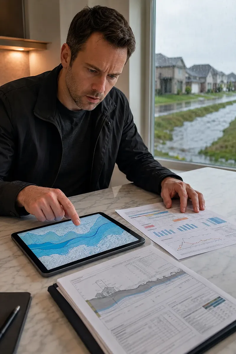
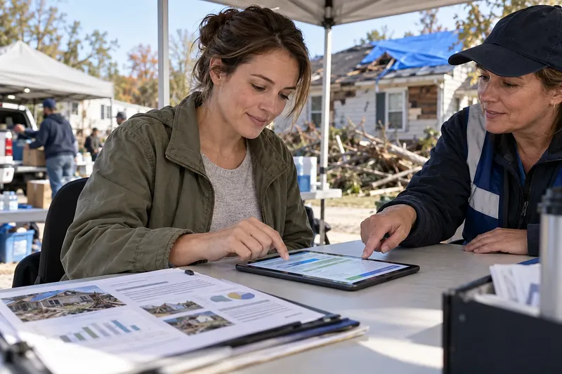
He checks address-specific flood risk and insurance information as rainwater collects outside.

Key points

  • Search the full address in the FEMA Flood Map Service Center.
  • Save the flood zone and effective FIRM panel information shown in the results.
  • Review the meanings of Zone X and AE together with the Elevation Certificate.
  • Ask the lender and insurer about insurance requirements and coverage.
  • If damage occurs, file an insurance claim and apply for disaster assistance separately.

Enter a U.S. address in the FEMA Flood Map Service Center to check Zone X or AE and the applicable FIRM panel. Check the FEMA official page for the information required for a search and whether applications have closed. Apply for disaster assistance only in declared areas, and check the deadline at DisasterAssistance.gov.

Based on relevant forecasts and cases as of August 2026; check FEMA official pages for program details

How to Look Up an Address on a FEMA Flood Map

Start your address search at the FEMA Flood Map Service Center. Have the street name and number, city, state, and ZIP code ready. For an apartment, search for the building address first.

  1. Open the FEMA Flood Map Service Center search page.
  2. Enter the property’s full address.
  3. Confirm the parcel’s location on the map.
  4. Read the zone designation, such as Zone X or AE.
  5. Record the effective FIRM panel number and effective date.
  6. Download and save the map or related report.

The search point may not align with the building. If so, compare it directly with the parcel location on the map. If the property is near a boundary, do not rely solely on the address result.

Interpreting Zone X and AE Results

Zone AE is a Special Flood Hazard Area with an established base flood elevation. This zone is associated with a flood having a 1% annual chance. It is not an indication predicting flooding within a specific period.

Zone X does not represent just one level of risk. Shaded Zone X may include areas with a 0.2% annual chance of flooding. Unshaded Zone X also does not mean that flooding is impossible.

Map result Basic meaning What to check next
Zone AE Special Flood Hazard Area with a base flood elevation shown Check the lender’s insurance requirements and the building elevation
Shaded Zone X Moderate-risk area on the map Review drainage, past flooding, and the need for insurance together
Unshaded Zone X Relatively lower-risk area on the map Separately check risks from localized heavy rain and drainage
Near a zone boundary The result may vary depending on the parcel or building location Compare the effective panel with survey records

Maps show flood risk across broad areas by zone. They do not fully reflect the drainage conditions of individual buildings. Nearby construction and terrain changes must also be checked separately.

Why Zones Differ Within the Same Development

Even within the same development, zones may differ if parcels have different elevations and locations. Distance from drainage channels and retention ponds can also make a difference. A map boundary may run through the development.

The lowest floor elevation of a building may also vary by parcel. An elevation certificate documents this vertical position. However, not every home has an existing certificate.

Existing records may be available from the following sources:

  • The seller or building owner
  • The local government department responsible for floodplain management
  • The building permit or property records department
  • A qualified survey professional

FEMA maps and actual survey results may differ. If the applicable conditions are met, a map change process such as a LOMA may be considered. A map change does not eliminate the physical flood risk itself.

Summary by Situation

The organizations and documents you need to check vary depending on your current situation. Start with the item in the table below that applies to you.

Current situation First step Documents or information to check
Before buying a home Look up the zone for each address Effective FIRM, elevation certificate, flood history
Using a mortgage Ask the lender whether insurance is mandatory Official zone determination and loan terms
Shown as Zone AE Check the building elevation and insurance terms Base flood elevation, elevation certificate
Shown as Zone X Do not assume there is no risk Drainage conditions and insurance quotes
Map recently revised Distinguish previous records from the effective map Panel effective date and revision history
Flood damage has already occurred Notify the insurer of the loss immediately Photos, videos, damage inventory, receipts
Living in a disaster-declared area Separately check eligibility for FEMA assistance Address, damage details, insurance information, application deadline

Even when federal regulations do not require it, a lender may require insurance. Premiums are also not determined solely by the zone letter. Multiple risk factors related to the building and location may be considered.

Comparing NFIP and Homeowners Insurance Coverage

Flood and wind damage are treated separately even when they result from the same hurricane. The direct cause of the damage and the policy terms determine whether coverage applies. First, distinguish the role of each type of insurance.

Category NFIP flood insurance Standard homeowners insurance FEMA individual disaster assistance
Conditions for activation A covered flood occurs while the policy is in effect A loss covered under the policy occurs A presidential disaster declaration and an individual eligibility review are required
Primary role Covered flood damage to the building or personal property Losses covered under the policy, such as fire and some wind damage Assistance for essential needs not met by insurance
Disaster declaration required No No Yes
Flood coverage Based on the purchased coverage and policy terms Separate flood insurance is generally required Does not replace insurance
Duplicate compensation Duplicate payment for the same loss is restricted May be coordinated with other payments Does not duplicate insurance payments for the same loss
Form of payment Insurance proceeds under the insurance contract Insurance proceeds under the insurance contract Assistance based on eligibility and program rules

The fact that an event is called a hurricane does not mean one policy covers everything. Storm surge and surface flooding may constitute flood damage. Check the homeowners insurance policy for wind-related damage.

Building coverage and personal property coverage may be separate. Check each item individually on the policy declarations page. Coverage limitations may apply to property in basement areas.

FEMA Disaster Assistance Eligibility and Deadlines

FEMA individual disaster assistance is not a substitute for flood insurance. The property must be in a designated area under a presidential disaster declaration. The applicant’s damage must also meet program criteria.

Application deadlines vary by disaster. Check the page for the applicable disaster at DisasterAssistance.gov. If an extension is announced, it will be reflected on the official page.

Prepare the following information before applying for assistance:

  • The address where the damage occurred and current contact information
  • Details of damage to the home and property
  • Types of insurance held and claim information
  • Information required to verify identity and household
  • Financial information required to register a payment method

If you have insurance, notify the insurer of the loss first. A FEMA application does not automatically initiate an insurance claim. You may register separately for disaster assistance even before an insurance payment decision is made.

Restrictions on duplicate assistance apply to the same loss. Keep the assistance determination letter together with the insurance payment details. Also check whether there is a requirement to maintain flood insurance in the future.

Steps for Filing an Insurance Claim Immediately After Flooding

After flood damage occurs, preserve evidence once safety has been secured. Even if repairs are urgent, document the damaged condition first. Check the policy and insurer instructions for claim deadlines.

  1. Check the safety of the electrical system and structures.
  2. Take photos and videos of damage in each area.
  3. Prepare an inventory of damaged items.
  4. Notify the NFIP insurer or insurance agent of the loss.
  5. Keep receipts for emergency expenses and temporary repairs.
  6. If the property is in a disaster-declared area, apply separately for FEMA assistance.

Conducting extensive demolition before insurer approval may make it harder to prove the loss. If items must be discarded for sanitary reasons, photograph them thoroughly first. When possible, retain samples in accordance with the claim instructions.

Examples of Address-Specific Determinations

Two addresses in the same residential development may produce different results. One parcel may be in Zone AE while another is in Zone X. Do not treat two homes as having the same risk based only on the development name.

For example, if a prospective purchase is in Zone AE, check the base flood elevation. Then compare the elevation certificate with the lender’s requirements. Ask the insurer separately about building and personal property coverage.

Do not stop checking even if another candidate is in Zone X. Check whether it is shaded and review the drainage facilities. Obtain and compare insurance terms for each address as well.

Checking Map Revisions and Lender Requirements

The currently effective FIRM generally takes priority for legal and financial decisions. Treat preliminary and historical maps as reference materials. Save both the panel number and effective date.

A lender’s determination may change after a map revision. Conversely, a lender may require insurance even outside a mandatory zone. Obtain the terms in writing before signing a contract.

Use the following order:

  1. Check the currently effective panel in MSC.
  2. See whether there is a recent revision or preliminary map.
  3. Request the lender’s flood-zone determination.
  4. Confirm the insurance effective date with the insurer.
  5. Review insurance-related deadlines in the purchase contract.

Do not assume that flood insurance takes effect immediately upon purchase. Waiting periods and exceptions may vary depending on the contract circumstances. Check with the insurer before a forecast storm arrives.

Common Mistakes

The most common mistake is interpreting Zone X as a no-risk area. FEMA maps do not guarantee the absence of risk. Drainage problems not shown on the map may also cause flooding.

  • Judging a parcel based only on the city name or ZIP code
  • Treating an outdated FIRM copy as the current map
  • Assuming all hurricane damage is covered by one policy
  • Thinking FEMA assistance is the same as insurance proceeds
  • Treating insurance enrollment and a disaster assistance application as procedures that replace each other
  • Assuming an elevation certificate automatically changes the mapped zone

Do not apply only for disaster assistance and delay notifying the insurer. The two processes have different purposes and reviews. Keep the submission numbers and documents for each process separately.

Keeping Records Before a Sale or Loan

It is safer to save the search results as an evidence package from the time of the transaction. Online maps may be revised later. Download the official panel rather than relying only on screenshots.

Keep the following materials in one folder:

  • FEMA search results showing the address
  • Effective FIRM panel and effective date
  • Elevation certificate or survey records
  • The lender’s flood insurance determination
  • Insurance quotes and coverage items
  • Flood-related records disclosed by the seller

These records help distinguish insurance requirements from the basis for the determination at the time. They can also be used to compare future map changes. However, historical files do not replace current risk information.

Where to Check Official Rules

Check the FEMA Flood Map Service Center for the exact map terminology. Zone descriptions are available on FloodSmart’s What Is My Flood Zone page. Check the relevant FEMA guidance for insurance and disaster assistance requirements.

Direct quotations from official rules are not included in this posting. Accordingly, no specific sentence has been quoted as if it were the original text of a regulation. Before making an actual decision, compare the latest official pages with the insurance policy.

See whether you qualify

Check the FEMA Flood Zone by Address

Have the exact address of the property in the United States ready. There is no deadline for the lookup, and you should review both the map results and the effective FIRM panel. FEMA website > Flood Maps > FEMA Flood Map Service Center.

You are leaving for an external site that Injoys does not operate. Please re-check eligibility, dates, and amounts on that institution's own notice.

Go to the official page

Opens in a new window.

Advertisement

Apply now

Apply for FEMA Disaster Assistance

You must have sustained damage in a designated area under a presidential disaster declaration and meet the eligibility criteria. Have the address of the damaged property, insurance information, and details of the damage ready, and check the deadline for each disaster. FEMA-operated DisasterAssistance.gov > Apply Online.

You are leaving for an external site that Injoys does not operate. Please re-check eligibility, dates, and amounts on that institution's own notice.

Go to the official page

Opens in a new window.

Advertisement

Sign-in required

Sign in with your Google account to like, comment, and save highlights.

Images

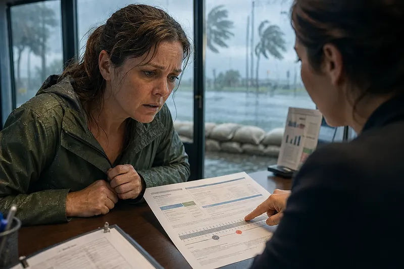
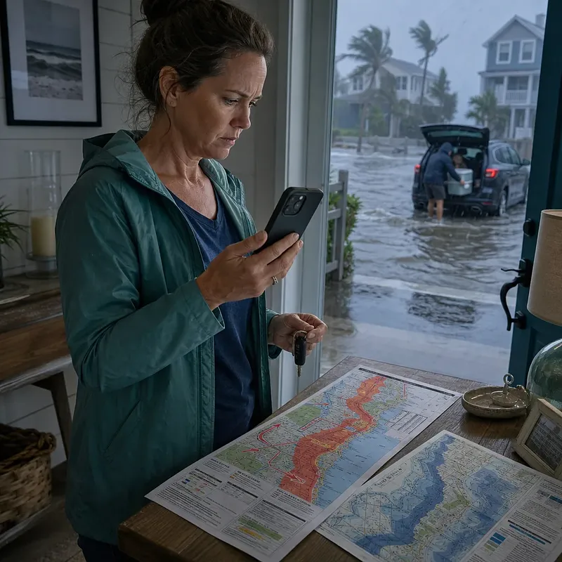
He checks address-specific flood risk and insurance information as rainwater collects outside.
The graphic shows how an address-based flood map connects to insurance and property damage information.

FAQ

If a property is in Zone X, is flood insurance unnecessary?

Zone X does not mean there is no flood risk. Even if the federal requirement does not apply, the lender may require insurance. Check the drainage conditions and insurance terms separately.

What does Zone AE mean?

Zone AE is a Special Flood Hazard Area with an established Base Flood Elevation. You should check the building elevation, loan terms, and flood insurance requirements together.

Can flood zones vary within the same residential development?

Yes, if lot elevations, drainage facilities, or map boundaries differ. You should look up the individual address and the building's actual location rather than the development name.

Does standard homeowners insurance cover hurricane flooding?

Standard homeowners insurance generally treats flooding, such as surface water inundation, separately. You should distinguish between the causes of wind damage and flood damage and check the terms of each insurance policy.

Does an NFIP insurance claim require a presidential disaster declaration?

A presidential disaster declaration is not required for a covered loss under a valid NFIP policy. FEMA Individual Assistance, on the other hand, requires a declaration, a designated area, and an individual eligibility review.

Does FEMA disaster assistance replace flood insurance?

No. Disaster assistance is a program that helps cover essential needs for those who meet the eligibility requirements. Restrictions on duplicate assistance apply to losses covered by insurance benefits.

Where can I obtain an Elevation Certificate?

Ask the seller, the local government's records department, or the floodplain administrator whether existing records are available. If no records are available, a qualified surveying professional may be required.

Is there a deadline for looking up FEMA maps?

Check FEMA's official page to determine whether there is a deadline for address-specific map lookups. The insurance effective date and the disaster assistance application deadline should be checked separately.

What should I do if the map seems incorrect?

First compare the effective FIRM with the survey data. If the requirements are met, you may consider an official map amendment procedure such as a LOMA.

Sources

Data formats

This content is available in several machine-friendly formats.

Data-only languages (machine translated, files only)

Indonesian JSON MD Portuguese JSON MD Chinese (Traditional) JSON MD Deutsch JSON MD

Verification

This article was drafted with AI and then reviewed and edited by a person.

Reviewed by 신익희 · 편집장 · 2026-09-07

Figures in this article were checked against the source material during generation. 2 correction(s) applied. · 2026-09-07

This translation has been cross-checked by AI. · 2026-09-07

Reuse & AI usage

Search indexing and AI citation with attribution are welcome. See the license policy for details.

CC BY · License

Loading…

Loading…

Related content

From Injoys

Request the content you want and take 70% of what it earns

Just leave the subject. We handle production, review, translation and distribution.

See how revenue sharing works

Comments